While I was gathering up my bags for the trip, it occurred to me that I'd have a chance to see what the rest of the city looked like as we drove to the airport, as also to see what the wildfires looked like from the air! So I packed my camera in my stuff and got ready as we took off to see some stuff...
On the Road
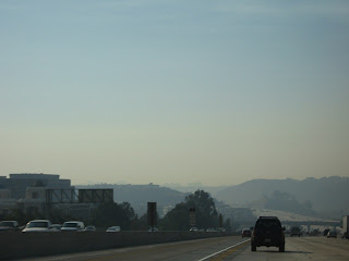
Here are a few shots from the road. There was pretty much a lot of two things - smoke and traffic:
sorry it's fuzzy - but you can see the thick haze everywhere and the sea of cars.
The approach to Carmel Valley...this is an interesting vista of how the smoke is just kind of a layer over everything in the city.
If you live in a city with smog this might not look strange to you. But here, the only time we don't have a crystal clear view of the landscape is when there is fog that rolls in from the ocean in the morning. This is definitely not that!
In the Air
At the airport, everything was empty. Eerily empty. I guess a lot of people were doing the same thing I did, cancelling travel plans until they knew better how to plan their next move. After making it through the security gate in record time and waiting at the terminal almost an hour, I finally boarded the plane, eagerly anticipating what I was going to see.
What I ended up seeing was a lot more smoke. Smoke obscured almost everything, so most of my pictures weren't that great. As we headed east and away from the ocean though, things changed a bit. I started to see more dinstinction between where the smoke was and where it wasn't, and an ominous layer of thick black that was already starting to settle over the area....
A coastline picture through the smoke
You can see us flying over the smoke in the air, and approaching an area where you can see beyond the haze
Below:
This picture was really telling - you can see the plumes of smoke still blowing in a very westerly direction, back toward the direction from where we came.

 Last photo: Blackened Earth


No comments:
Post a Comment